The Tel Aviv Light Rail Transit System – The Green Line – Central Segment
- Service Type Road Planning Traffic and transportation engineering Planning Management
- Client Name NTA Metropolitan Mass Transit System
- Project Type Mass Transit Systems Tunnels
- Execution Budget4.5 billion NIS
- Planning Timeframe4.5 years
- Length of Roads6.8 km
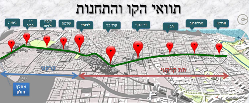
The Green Line is part of the Light Transit System of the Tel Aviv Metropolis. The line connects the southern areas of the Gush Dan Metropolitan Area (Holon and the outskirts of Rishon LeTzion) to Tel Aviv. As the connection line of the planned mass transit system, it will serve future developments along the coast between Tel Aviv and Herzeliyah and improve access to the employment areas in Ramat HaHayal, Tel Aviv University, Holon and Rishon LeTzion. The line’s route is 39 km long, 4.5 of them underground, and includes 60 stops, 4 of them subterranean (Karlibach, Dizengoff, Rabin Square/Municipality and Arlozorov stations).
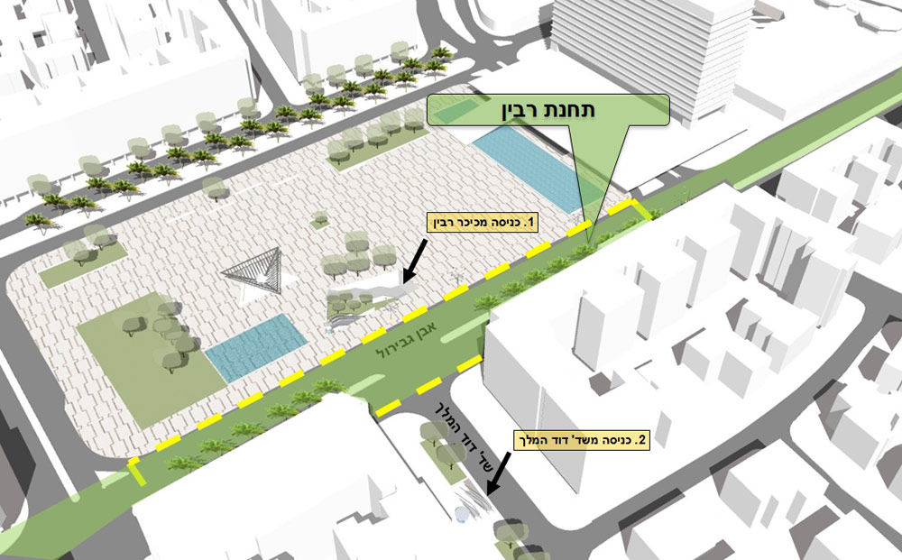
Our firm won the tender for the planning of the central segment of the Green Line, which will cross Tel Aviv from north to south. The route’s middle point will be located on Ibn Gvirol and Karlibach streets – an urban area with mixed land uses, including residential, commercial and business. This busy urban area is characterized by commercial facades and crowded roundabouts and sidewalks. Throughout our planning process, we strove to minimize the impact on the public that lives and works in the area, as well as pedestrians and cyclers passing through it.
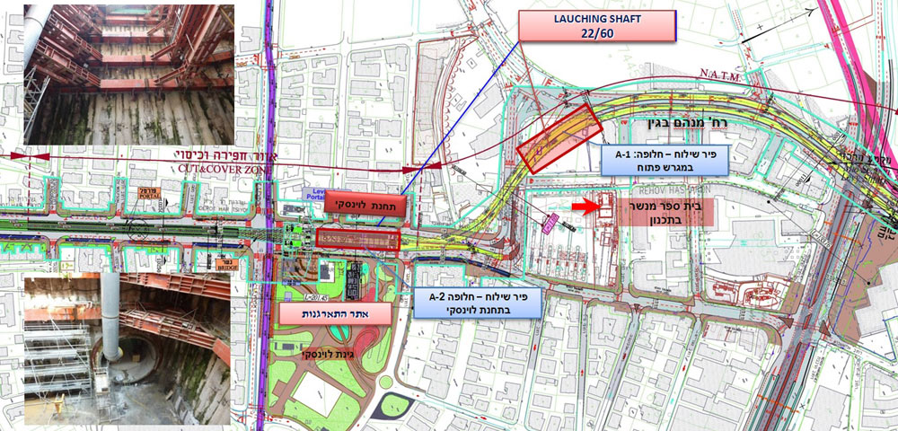
The segment is 6.8 km long, 4.5 of them subterranean, and passes through crowded areas laden with infrastructures. The segment plan includes 9 stops, 4 of them subterranean; 2 portals and 2 launch shafts.
A video about the project is available here